| Description: | This is a nice, relatively short hike that takes you across the ridge of the Santa Monica mountains, and ends up at the foundation of a no-longer-extant observation tower. The foundation provides a decent sitting point, as well as a very nice view of Topanga Canyon and portions of the Valley.
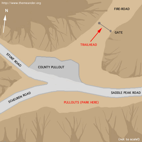
Follow the trail from the trailhead shown in the map below. As the fire-road rises, it curves gently off to the right. After a short ways, there is a branching point. Follow the trail to the left; the right will take you to a restricted area full of antennas (according to Hiking Trails of the Santa Monica Mountains by Milt McAuley, it's an out of service military facility). Now the road winds out down along a flanking ridge, and levels out. The very end is a short scramble up a steep hill to the foundation itself. |
| How to get there: |
From Samuel's House:
Take Meier South to Venice
From the Valley:
Generate a custom online map.
|
| Notes: | We have on several occasions run into drumming circles up here, and merged events. |